Before the Lake Wallenpaupack dam and levee were built in 1924 – 1926, the small town of Wilsonville, PA existed right in front of where the dam exists currently.
History of Wilsonville, PA
Did you know that William Penn originally owned the land where Wilsonville was built? In fact, William Penn deeded it to his son Thomas Penn prior to his death. After Thomas Penn’s death, the land went to their estate which ultimately ended up selling the 12,000+ acres in 1793 to James Wilson — one of the first justices of the Supreme Court and a signer of the Declaration of Independance. Wilsonville was named after James Wilson.
Wilson died in 1804, and six years later his land was sold at a sheriff’s sale. When electric company Pennsylvania Power & Light (PP&L) created their plan to build a dam for the purposes of providing water to its hydroelectric station in Kimbles, they notified the 100+ landowners who occupied the land of their intent. Commercial and residential land was sold to PP&L at about $20/acre and most of the property was knocked down or relocated. Some foundations remained after houses were destroyed, and rumor has it that even during flooding, the water was so clear you could see the foundations underwater. Prior to the flooding, local loggers were contracted to cut down trees and leave behind stumps. Not all trees were removed however, and you can still see some standing tall beneath the surface with your sonar equipment. Around seventeen miles of roads and telephone poles were rerouted, and an entire cemetery had to be relocated. What remained in the town is now totally underwater and preserved.
Existing Roadways (Now and Then)
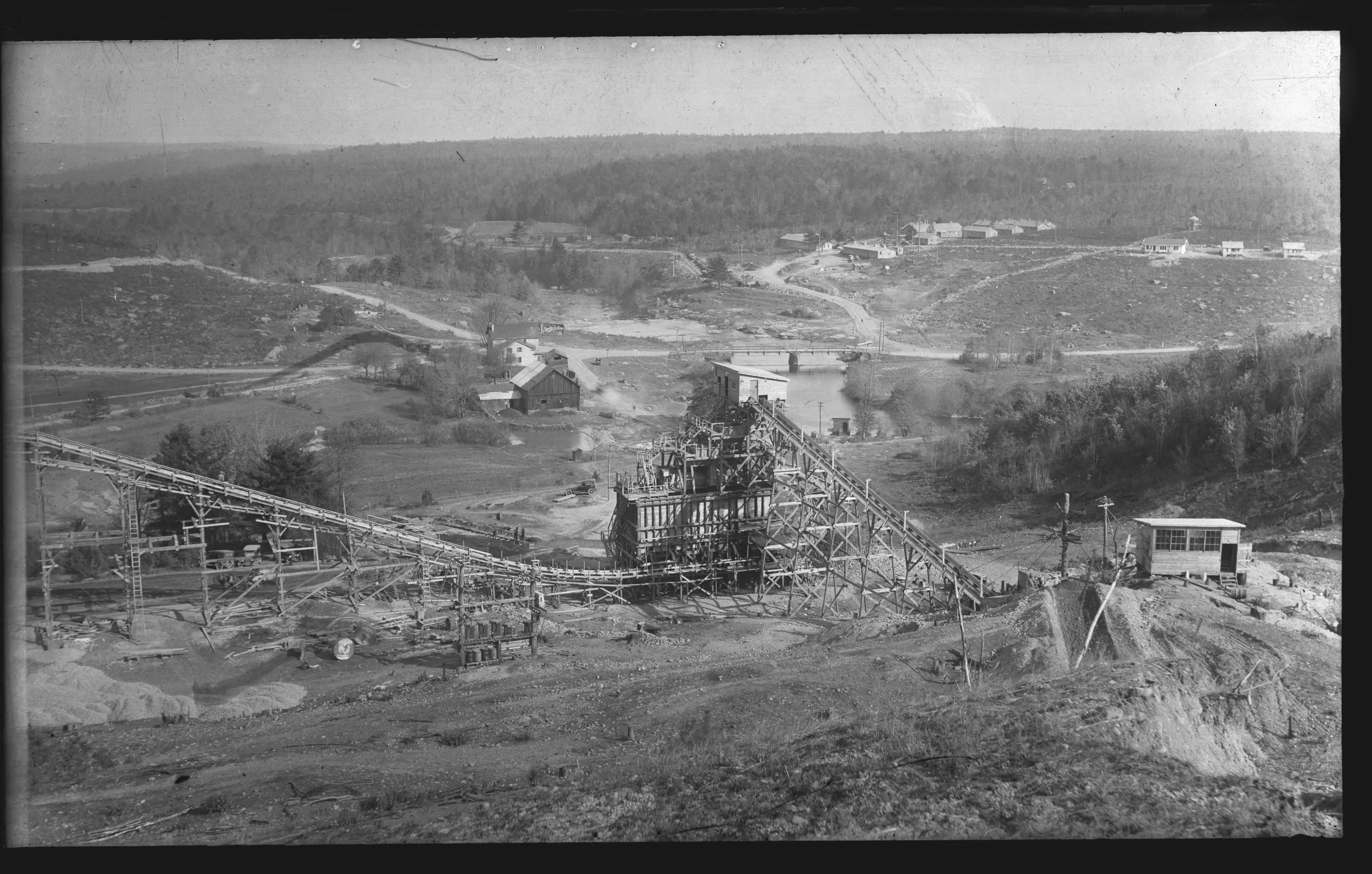
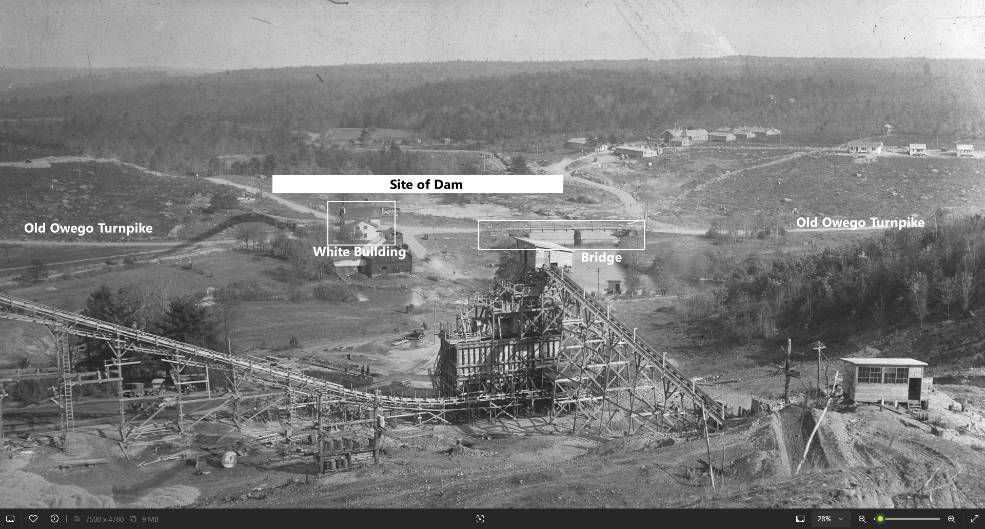
Historical records show that Welwood Avenue in Hawley (known today as Route 6) was the way people would travel from Honesdale to get to Wilsonville. The road out of Hawley crossed the (then) Milford-Owego Turnpike just above a bridge that crossed Wallenpaupack Creek in Wilsonville (pictured below).
Therefore, we know that part of the old Owego Turnpike is submerged beneath the northern tip of Lake Wallenpaupack. In fact, the entrance road into the Woodlyn Shore development is part of the old turnpike.
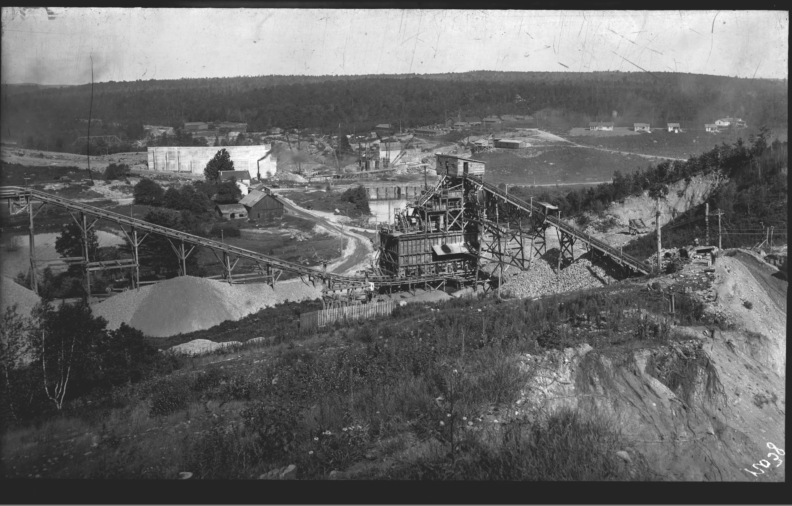
The images below can be used, alongside with our Wallenpaupack Map, to help visualize what lies beneath the water at the Dam. Credit for these images given to Wallenpaupack Historical Society.
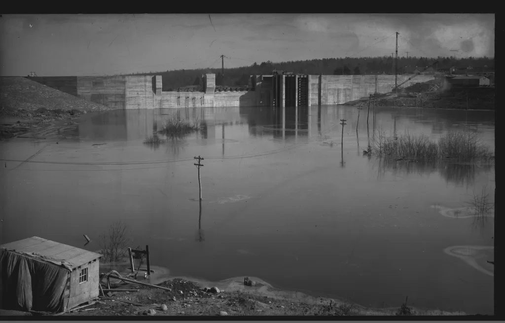
Flooding the Dam
The flooding began after the buildings were demolished or moved and most trees were cut down. Flooding actually started while construction of the dam was still happening. The photo below depicts the area right in front of the dam being flooded. It’s crazy to think about the structure and material that remained in place during the flooding.
Hopefully this history explains the success of today’s fishing up by the dam today. The area is riddled with structure and elevation changes. We strongly urge anyone interested in learning more and those who love old photos to visit the Wallenpaupack Historical Society — https://www.wallenpaupackhistorical.org/exhibits. They have records and photos dating back to the early 1900s that show amazing photos of what used to be. In fact, Wallenpaupack turns 100 years old next year and the Historical Society is releasing “LAKE WALLENPAUPACK’S CENTENNIAL ANNIVERSARY BOOK” in December 2025 to recognize the anniversary.