We recently reached out to the Tafton Dive Team via Facebook (go Like their page) and asked them to share some underwater sonar images with us. These images can help give us anglers some insight into what lurks beneath the surface. Using side-scan sonar, the Tafton Dive Team is able to survey the lake to get an understanding of what the bottom looks like. Side-scan sonar picks up structures, rock formations, vegetation, and even sunken boats.
DID YOU KNOW? The Tafton Dive Team proudly serves on Lake Wallenpaupack in Palmyra Township, Pike County Pennsylvania as part of the Tafton Volunteer Fire Company.
When looking at side-scan sonar, you should know that the blank area directly in the middle of the image (which looks like a mirror image of itself) is actually the area beneath the ship that the transducer is mounted to. If you’ve never seen side-scan sonar imaging before, check out this quick article for a summary.
Boat Ramp and Public Launch
The public boat ramp was used as a roadway to build the dam during construction. Remnants of the roadways can be seen in the side-scan and down imaging.
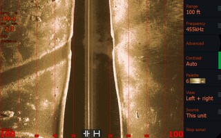
Sunken Boat
Can you spot the sunken boat in this side-scan sonar image? It’s about 70ft to the right from the boat during the time this image was taken.
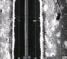
Side-Scan Sonar Imaging of Active Divers
If you look closely, you can see a few Tafton Dive Team divers around 50 ft to the left of the boat. The side-scan sonar picks up their bodies as well as the bubbles as they rise to the surface. Would you be brave enough to dive 20+ ft down to the bottom?
Collapsed Bridge and Roadways
In this side-scan image, you can see the remnants of an old bridge that has since turned into a pile of debris. On the right-side, evidence of a roadway is still visible.
Sunken Town and Building Foundations
Now underwater, these foundations used to provide support for old homes and buildings in the old town of Wilsonville prior to flooding the lake.
Stone-walled Roadways
Many of the paths prior to the flooding were stone-walled roadways. Evidence of the stone-walled roads can be seen in the side-scan imaging above.
Porcupine Cribbing
Many anglers know of the submerged structures throughout the Lake provided by the PA Fish and Boat Commission. We recently featured an article about Porcupine Cribs! In this side-scan and down imaging, you can see the spread of dozens of porcupine cribs submerged in about 15-20ft of water.
Tackle and Fish!
Thousands of broken off lures and tackle can be found scattered across the bottom of Lake Wallenpaupack. The Tafton Dive Team also can verify — there are plenty of fish down there for the catching!
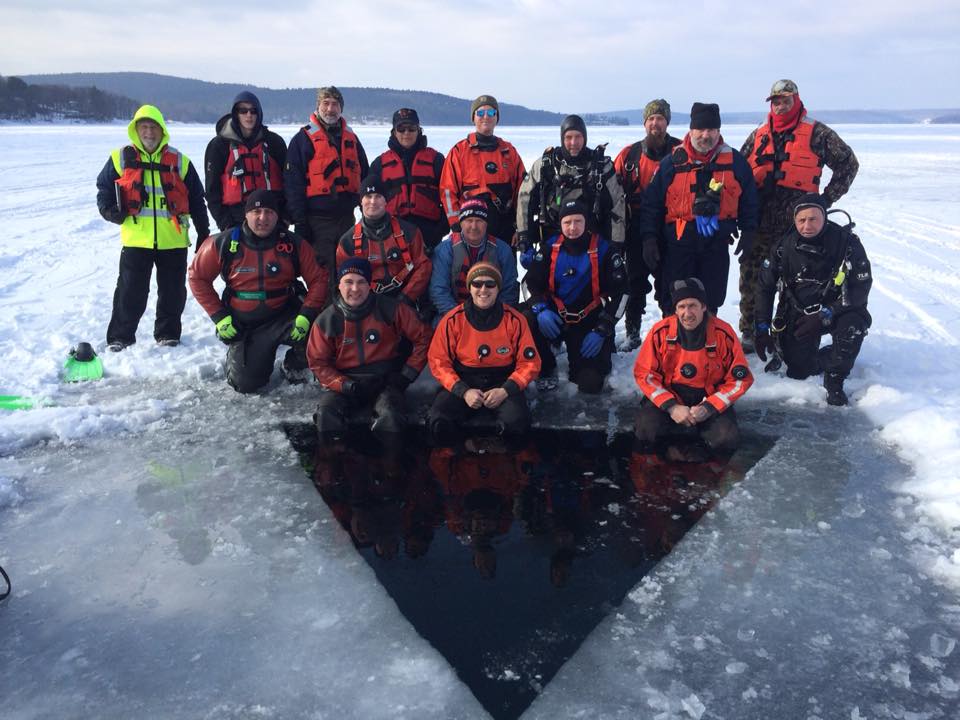
Wally BITES wants to give a special thank you to Tafton Dive Team Captain Richard Groo for working with us to provide these amazing underwater images. We strongly encourage you to visit them on Facebook and give them a like/follow. They post pretty regularly and give updates on dive and recovery missions.